
Pleasanton ZIP Codes By Area
Pleasanton is primarily served by 94566 and 94588. Official city material calls these Pleasanton’s two ZIP codes. Mapping datasets show small overlaps with Dublin 94568 near the northern edge and Sunol 94586 near the southern edge. Those are postal and city-limit edge cases, not extra core Pleasanton identities. USPS also cautions that ZIP boundaries do not necessarily follow municipal lines. The table keeps core delivery areas separate from overlap geography, which prevents a postal label from being treated as proof of city jurisdiction.
| ZIP | Areas Covered | Post Office | Notes |
|---|---|---|---|
| 94566 | Historic downtown, southern and eastern Pleasanton, and surrounding rural fringe | Pleasanton | Core ZIP; older street and deed context |
| 94588 | Northern and western Pleasanton, Hacienda, Stoneridge, and newer development | Pleasanton | Core ZIP; modern planning and parcel context |
| 94568 overlap | Dublin postal geography near the northern city edge | Dublin | Verify address by address; not a core Pleasanton ZIP |
| 94586 overlap | Sunol and rural postal geography near the southern edge | Sunol | City and ZIP mismatch; verify parcel and USPS |
A Pleasanton ZIP code directory should emphasize the two core rows. The edge rows explain why a mailing search can return a nearby postal identity without proving that the parcel lies inside Pleasanton. Station names were unverified; the table uses postal city identities.
94566: Pleasanton’s Older Records
94566 is the core that best fits historic downtown, southern and eastern Pleasanton, and the surrounding rural fringe. That geography matters because downtown around Main Street retains nineteenth- and early-twentieth-century evidence in newspapers, deeds, and historic surveys. Rural-edge addresses can carry a Pleasanton postal label while falling outside incorporated limits, so the label still needs a parcel check.
The 94566 ZIP code also meets Alameda County’s record timeline. Official public records date to 1853, while electronic party-name indexing begins in 1969. Research before 1969 moves to the Oakland Clerk-Recorder counter and older grantor-grantee books; mail or in-person requests need a locator such as book/page or reel/image. The Alameda County Official Public Records index is the online starting point for 1969-present. It is a name index, not a ZIP or address index.
For local context, Museum on Main newspaper holdings are a discovery source, not a ZIP-indexed resident source.
Note: 94566 research often reaches older land records sooner because historic downtown and rural parcels need legal-description checks.
94588: Pleasanton Northern Districts
94588 covers northern and western Pleasanton, including Hacienda, Stoneridge, and newer development. Its record trail is more likely to begin with modern parcel, permit, planning, district, association, or corporate records. Large commercial parcels and association addresses can produce named business contacts without showing a household. Keep an entity or agent separate from a parcel owner and from a private individual.
The Pleasanton landscape-maintenance district information supplies named district and boundary context that can help place local terms without turning them into resident rosters.

District names in city material include Bonde Ranch, Windsor, Ironwood, Village at Ironwood, Autumn Glen/Heritage Valley, Danbury Park, Stoneridge Park, and Mohr/Martin. Use a neighborhood name as a project or map clue, then confirm the parcel and agency.
Finding Pleasanton Residents by ZIP
A ZIP code search in Pleasanton is a routing task, not a promise of an all-person list. Start with USPS, then move to county parcel geography. The assessor documents APN, site address, and map selection as public keys. That keeps the workflow within documented limits.
The first check is the USPS lookup by address, the authority for a standardized mailing city and ZIP+4.
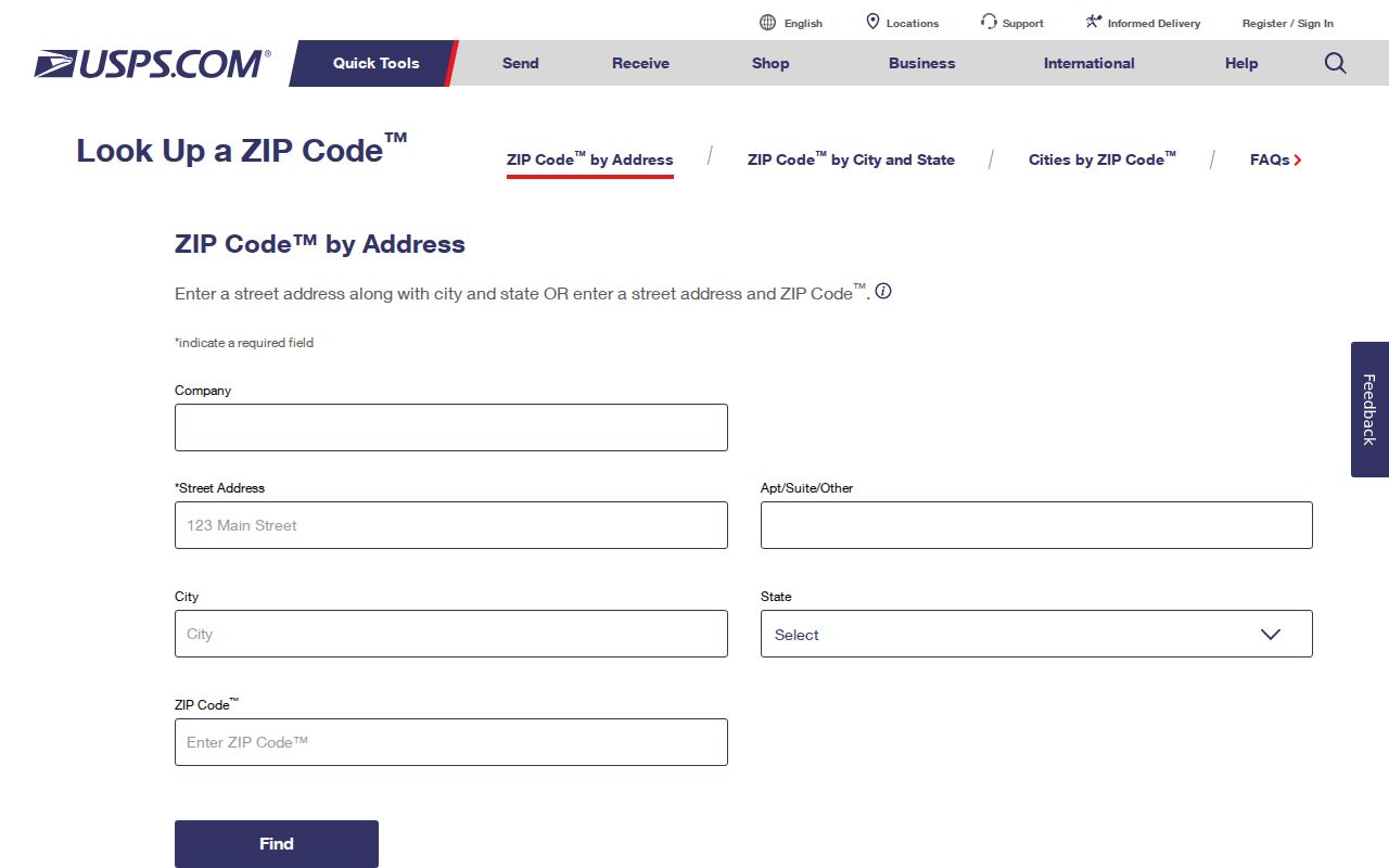
USPS settles mail routing; county GIS decides if the parcel lies inside Pleasanton.
- Run the full street address through USPS. Save the standardized mailing city, five-digit ZIP, and ZIP+4.
- Open the Alameda County Parcel Viewer. Search the site address or select the parcel on the map, then save the APN, situs, map reference, and boundary context.
- Use Alameda County Property Assessment Information with the APN, site address, or map. Do not expect a ZIP or unrestricted owner-name mode. The Oakland lobby and Dublin satellite are counter channels for human help and older assessment material, subject to retention rules.
- For land records, carry the APN and legal description to the Clerk-Recorder’s party-name index. Use the online run for 1969-present, the counter for 1853-present, and mail or in-person requests with a known book/page, reel/image, or instrument locator. Call (510) 272-6362 or (888) 280-7708 for ordering questions; archives and genealogy databases may hold derivative microfilm or catalog references; the recorder remains legal custodian. The Treasurer-Tax Collector is a separate parcel-keyed channel for tax status and mailing context.
- For city-held permits and planning files, use Pleasanton’s building and permit services. A narrow public-records request can seek identifiable city records. For voter status, use California My Voter Status; it is a self-authenticated lookup, not ZIP browse, and voter-file releases require an authorized purpose. A failed match can go to Alameda Registrar of Voters at (510) 272-6933 or the SOS.
Once a ZIP narrows the area, the Pleasanton street directory handles the separate street-by-street address chain. Save each result with its date, source, and boundary note.
Alameda ZIP Search Fields
Alameda’s parcel tools support parcel work, not ZIP browsing. The Alameda County Parcel Viewer lets a searcher work from a site address, APN, or map selection. It can expose parcel geometry, identifiers, and available context layers; it may not show owner names. The assessor’s public overview likewise does not verify an unrestricted owner-name mode. Use the field set as a bridge from a postal address to a parcel.
| Field Label | Type | Required | Options / Format Notes |
|---|---|---|---|
| APN | text | no | Parcel identifier |
| Site Address | text/autocomplete | no | Physical address, not mailing address |
| Map click/select | map tool | no | Choose a parcel visually |
| Zoom/pan | map control | no | Browse streets and adjacent parcels |
| Layers | checkbox/menu | no | Parcels and available jurisdiction or context layers |
After a parcel is found, the APN is the handoff to assessment, tax, map, and deed work. An APN can change after a parcel split or merger. A map layer may help view a ZIP polygon if enabled, but no formal boundary shapefile or ZIP export was verified.
Note: Alameda’s documented parcel keys locate land; they do not turn the assessor into a verified ZIP-wide resident directory.
Pleasanton ZIP Limits and City Lines
USPS postal geography and Pleasanton city limits answer different questions. A Pleasanton mailing label can reach land outside incorporated limits, and an edge parcel can carry Dublin or Sunol postal identity. The parcel map decides jurisdiction and which agency keeps permits or planning files.
The Pleasanton public-records channel is for identifiable city records such as permits, planning files, council records, or administrative material. The California Public Records Act, Gov. Code §§7920.000-7931.000, allows a person to request identifiable public records, but it does not make county deeds, voter fields, court files, or vital certificates into a ZIP list. County deeds remain with the Clerk-Recorder.
Jurisdiction check. Save the parcel APN and map view before treating a ZIP result as a Pleasanton record lead.
Dublin and Sunol ZIP Overlaps
The 94568 and 94586 ZIP code overlaps sit at different edges. 94568 appears near Pleasanton’s northern city edge as Dublin postal geography. 94586 appears near the southern edge as Sunol or rural postal geography. Both are overlap cases. They are not core Pleasanton postal identities, and a map polygon that touches the city does not put every address in the city’s ZIP table.
Test an edge address in full. USPS supplies postal city and ZIP+4. County GIS supplies parcel location and boundary context. If those answers differ, preserve both facts and use the jurisdiction result for city permits and planning. No official source inspected verified a Pleasanton PO-box-only ZIP, a unique institutional ZIP, or a ZIP split or realignment year. Those gaps should remain stated as unknown.
Note: Edge addresses need two checks because postal routing and municipal jurisdiction can point to different record custodians.
Pleasanton Situs, Mailing, and APN
Address terms keep a Pleasanton search grounded. Situs is the physical location of the parcel. Mailing is the tax or contact destination, which may be elsewhere. A legal description, such as a subdivision and lot reference or metes-and-bounds text, identifies the land beyond postal numbering. APN is the assessor’s parcel key. It joins the map, assessment, tax, and deed trail, though a parcel split or merger can change the APN.
Neighborhood names add context, not proof. Bonde Ranch, Windsor, Ironwood, Village at Ironwood, Autumn Glen/Heritage Valley, Danbury Park, Stoneridge Park, and Mohr/Martin can help locate city planning packets or permits. Match the name to the site address, APN, and recorded legal description before connecting it to a person or household.
Address caution. A tax mailing address may identify the taxpayer’s contact point, not an occupant.
Note: A legal description can preserve parcel identity when a postal number changes, but it still needs a recorded map or deed check.
Pleasanton ZIP Search Terms
Postal terms are easy to mix. A careful Pleasanton ZIP code directory uses each one for its proper job, then leaves people and jurisdiction questions to the right custodian.
- ZIP code
- A five-digit postal routing area used to sort and deliver mail. It is not a parcel boundary or a resident roll.
- ZIP+4
- Four added digits that refine delivery to a segment, building, or box. USPS controls the result; the suffix does not set city limits.
- PO-box ZIP
- A postal code used for post-office boxes rather than standard street delivery. No Pleasanton-only PO-box ZIP was verified.
- Unique ZIP
- A code assigned to one high-volume institution or organization. No unique institutional Pleasanton ZIP was verified.
- Carrier route
- A delivery route within a postal area. It helps mail operations, not a public map of people or parcels.
ZIP code geography can organize an inquiry, but it cannot produce a verified current resident roll. My Voter Status is self-authenticated, and voter files are restricted by Elections Code §2194; Government Code §7924.000 protects specified identifiers and address details. Assessment and tax records show parcel-linked administrative clues. Recorded deeds show named parties to instruments. None alone proves who sleeps at an address. Use official records, date each result, and avoid turning a postal region into a claim about a person.