
Tracing a Pleasanton Street
A Pleasanton street search works best as a chain, not as one claim about a household. Start with the full Pleasanton address, find its parcel, read assessment context, then move to named deeds, project records, and dated household clues. These sources can point toward an owner or listed occupant, but they do not create a complete roster of everyone at the address.
Keep one evidence note for each address. Save the spelling, source, date, and field type: situs, mailing destination, named party, project role, or inferred occupant.
- Normalize the address. Use the USPS address lookup, then retain the Pleasanton spelling.
- Find the parcel. Search for the Pleasanton parcel in the Alameda County Parcel Viewer by site address, APN, or map selection. Save the APN and situs.
- Read assessment context. Use the APN or site address, and separate Pleasanton assessment data from occupancy.
- Build the deed chain. Search the Alameda County official-records index by grantor and grantee variants. Compare dates and legal descriptions.
- Add dated clues. Treat voter status as a self-lookup; use reverse directories, census snapshots, or newspapers only with clear dates.
The Pleasanton flow is address to APN and situs, then assessment, instrument, legal description, and dated context. Every step states what the record proves.
Pleasanton Street Directory Records
Pleasanton address evidence is split among Pleasanton city, Alameda County, state, and historical custodians. The Alameda County Assessor and Parcel Viewer describe land and assessment context. The Clerk-Recorder holds the named-document trail. The Treasurer-Tax Collector adds tax status and the mailing destination on a tax account. Pleasanton Community Development records project roles. California voter status is a self-lookup with statutory limits, not a public street list.
| Address source | Keeper | What it can show | Access channel |
|---|---|---|---|
| Pleasanton parcel and assessment | Alameda County Assessor | APN, situs, assessed land and improvement values, map and tax links | Free APN, site-address, or map search; counter fallback |
| Deeds and official records | Alameda County Auditor-Controller/Clerk-Recorder | Named parties, instrument number and date, legal description | Free name index from 1969 forward; counter search back to 1853; paid copies |
| Tax bill | Alameda County Treasurer-Tax Collector | Assessment or tax status and the tax mailing destination | Parcel-keyed online view; payment channels where applicable |
| GIS parcel map | Alameda County Parcel Viewer | Parcel geometry, APNs, and available jurisdiction or context layers | Free interactive map browsing |
| Pleasanton permits | Pleasanton Community Development | Applicant, contractor, work description, and project dates | Pleasanton portal, records request, or counter channel |
| Voter status | California Secretary of State and Alameda Elections | One authenticated voter’s registration status and election details | Self-lookup; voter-file release is restricted by statute |
The Pleasanton parcel number is the useful bridge. It can connect a map selection to assessment and tax material, while the legal description can connect a deed to the same land even when a postal address has changed. A street name helps organize the search, but it does not replace the parcel, instrument, or date that supports a conclusion.
GIS Fields for the Pleasanton Street Directory
The GIS side of a Pleasanton street directory is a map task. The Alameda County Parcel Viewer accepts a Pleasanton site address, APN, or visual selection. Save the target APN before inspecting nearby lots.
| Field | Type | Required | Notes |
|---|---|---|---|
| APN | Text | No | Parcel identifier; keep it as the cross-reference for assessment and tax records. |
| Site Address | Text or autocomplete | No | Physical Pleasanton address of the parcel, not the tax mailing address. |
| Map click/select | Map tool | No | Choose a parcel visually when the typed address does not resolve cleanly. |
| Zoom/pan | Map control | No | Browse a Pleasanton street and the parcels beside or across from the target. |
| Layers | Checkbox or menu | No | Parcels and available jurisdiction or context layers, which should be dated when used. |
The Pleasanton property information describes search by APN, site address, or map selection, but does not verify an unrestricted owner-name mode. A Pleasanton map reveals land without promising names. Move from the map to the custodian that supports the next claim.
Note: A map selection can identify a parcel without proving who owns it or who occupies it on a given day.
Reading a Pleasanton Parcel
The assessor record needs a careful read. The physical Pleasanton situs tells where the parcel sits; the tax-bill mailing address tells where notices go. They may point to different places, and neither alone proves who lives there. An APN can be more useful than a name when a street has similar numbers or an older form.
For a Pleasanton researcher, the Alameda County Assessor lists 1221 Oak Street, Room 145, Oakland, plus a Dublin satellite at 7600 Dublin Boulevard #270. Both list weekday lobby hours of 9:00 to 4:30. The main phone is (510) 272-3787; the general email is AssessorWebResponse@acgov.org. The Dublin counter is a practical access point for Pleasanton research.
Address terms. Four definitions keep a Pleasanton street directory from turning Pleasanton land data into a household claim.
- Parcel
- A county assessment unit in Pleasanton identified by an APN. It describes land, not people.
- Situs address
- The physical location of the parcel. It is distinct from a tax or postal mailing destination.
- Plat
- A recorded map of lots, blocks, or streets that helps tie a legal description to land.
- Criss-cross directory
- A Pleasanton reverse directory can list an occupant or phone for one publication year.
Parcel splits and mergers can change an APN. A subdivision lot, plat, or metes-and-bounds description may bridge to an older deed. Record the date and source before comparing another Pleasanton record.
Pleasanton GIS Street Browse
Map browsing adds the Pleasanton street shape that text cannot. Search the Pleasanton situs, zoom to parcel outlines, save its APN, then inspect parcels sharing a boundary or sitting across the street. Repeat for each parcel that matters. The result is a working street list, not an occupant directory.
Pleasanton layers may add parcel, jurisdiction, zoning, general-plan, flood, school or district, and aerial context. Date them because they describe setting, not household identity. No Pleasanton radius or buffer export was verified. Use parcel-by-parcel selection, not an automatic nearby-person result.
Note: Adjacent on a Pleasanton map means a parcel relationship; it does not establish a family, ownership, or household relationship.
Pleasanton Deeds Behind an Address
Once the Pleasanton parcel and legal description are saved, the recorder index supplies the named-document trail. Alameda County records are keyed by parties, so search grantor and grantee variants rather than expect an address-only deed search. Compare each acquisition instrument, date, party, and legal description with the seller’s earlier record.
Liens, releases, easements, deeds of trust, judgments, and notices can add chronology without transferring title. The recorded image supplies the legal description and terms. A named deed party is not automatically a current resident on a Pleasanton street-directory result.
For a Pleasanton search, the Alameda County Official Public Records entrance identifies the recorded-document trail and online index boundary.
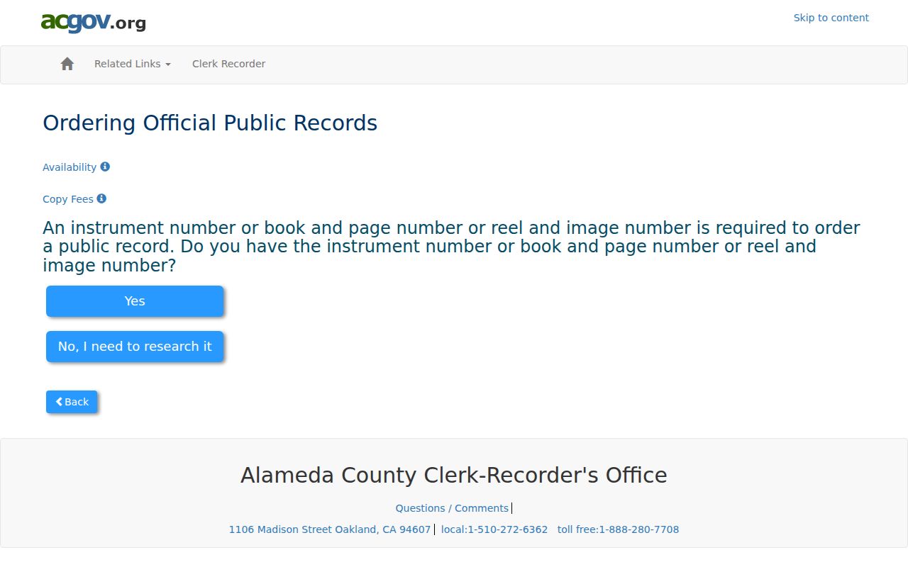
Test the Pleasanton party-name path before ordering a copy or moving to older books. Keep the indexed spelling, party role, document type, date, instrument number, and any book, page, reel, or image reference.
- Party names: indexed roles, often grantor and grantee.
- Placement: instrument number, or older book/page or reel/image.
- Substance: document type and date; the image supplies terms.
- Image access: paid copies; pre-1969 searching is office-only.
- Redactions: sensitive identifiers are governed by California law.
The 1969 Pleasanton Boundary
Alameda County official public records begin in 1853, while the Pleasanton electronic name index begins in 1969. A blank online result may mean the deed is older than the electronic run. Records from 1853 through 1968 require an in-person or mail search through older grantor-grantee references.
The Clerk-Recorder is at 1106 Madison Street, Oakland. Older Pleasanton references use alphabetic party books and book/page or reel/image locators. New recordings may take two weeks before a copy can be ordered, so record both search and result dates.
The Alameda County online official-records copy order shows the separate ordering path and requires an instrument number.
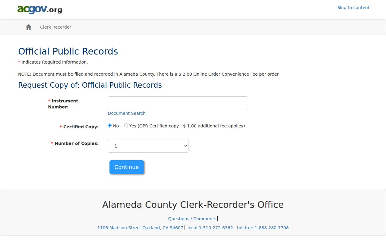
The copy form belongs after the index search. For older Pleasanton land, move from the modern index to the Oakland counter and use Pleasanton legal descriptions or plat references to hold the chain to the right parcel.
Recorder Costs for Pleasanton Deeds
Pleasanton copy access has a different purpose from index access. A free name search can identify an instrument, while a paid copy supplies the page image needed to read the legal description or document terms. Alameda County lists a plain copy at $3.50 per page. A certified copy costs $4.50 for the first page and $3.50 for each additional page.
The Pleasanton copy path follows the Alameda County Clerk-Recorder fee schedule, which gives the charge and payment path.
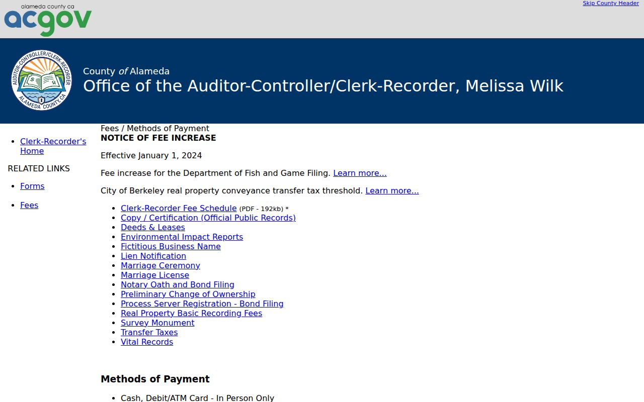
The fee schedule helps distinguish the copy price from the search itself. It also gives a Pleasanton researcher a way to plan the next step before leaving the online index.
Pleasanton online orders add a $2 convenience fee, require Visa or MasterCard, and use the instrument number. Mail requests accept checks or money orders, not credit cards, and require a self-addressed stamped envelope; the normal mail time is 5 to 10 business days. In person, printing stops at 4:15 p.m., and requests made after 4 p.m. move to the next day. For procedural questions, call (510) 272-6362 or (888) 280-7708.
Situs and Mailing in Pleasanton
The Pleasanton situs is the land’s physical place. The mailing address is where a tax bill or notice goes. They may point to different places, and neither alone proves who lives at the property. Label each street-directory result by field.
Pleasanton address continuity can break through subdivision, annexation, road realignment, and postal standardization. No authoritative source verified a citywide Pleasanton renumbering year. Use APN, legal description, plat, historic map, cross streets, and directory street guides before linking old and new numbers.
Pleasanton postal geography is primarily 94566 and 94588, with small mapping overlaps for Dublin 94568 and Sunol 94586. A Pleasanton mailing label does not prove city jurisdiction. The parcel map controls land context; postal lookup controls the mailing result.
Pleasanton Permits and Projects
A Pleasanton address search can add a project layer to a street directory. Building and permit records may show work description, construction or remodel timing, applicant, and contractor. Those are project roles, not proof of title or a complete list of people at the address.
The Pleasanton building and permit services channel is the city starting point. Its Pleasanton dynamic system did not expose a stable field list in the research capture, so retain the permit number or address used. If an existing record is not online, the Pleasanton public-records channel can receive a narrow request under the California Public Records Act, Government Code §§7920.000-7931.000.
Pleasanton CPRA access does not require a new resident list or an answer to an open-ended questionnaire. Request an existing permit, inspection, or project record, then compare it with parcel and deed evidence.
Note: A permit name identifies a project role, so the deed and parcel record remain the better ownership checks.
Criss-Cross Clues for Pleasanton Streets
A Pleasanton criss-cross directory reverses the name-first order. It starts with a street and number, then may list a person or phone for one publication year. Coverage can omit rural residents or a whole year, and a listing does not prove continued occupancy.
Pleasanton’s exact reverse-directory run is not officially published. Check Pleasanton Library, Museum on Main, and Pleasanton regional collections for surviving volumes. Census households reach through 1950, and newspapers can add dated property or family notices. Historical Pleasanton city directory collections supply collection context.
Match any Pleasanton listing to the parcel, deed or permit date. Its absence does not prove that a household was absent.
What the Pleasanton Street Directory Misses
No Pleasanton street directory can promise a complete list of people at an address. Parcels, deeds, permits, reverse directories, census records, and the Pleasanton parcel record each cover a defined record or date. Household members, minors, private contacts, utility customers, and protected residents are not assembled into an open street roll.
A Pleasanton voter checking California My Voter Status must self-authenticate. The portal asks for name, date of birth, and a California driver license or ID number or last four Social Security digits. A matched user can see registration and election details, but it is not a name-and-street search; new online registrations may take at least 24 hours to appear.
The California My Voter Status portal is for a person checking their own record, not browsing Pleasanton voters. Elections Code §2194 limits voter-file release to election, scholarly, journalistic, political, or governmental purposes, and commercial use is prohibited. Government Code §7924.000 protects home addresses, contact data, identifiers, and signatures except as authorized.
Lawful personal use. Pleasanton address and property records can support genealogy, property history, civic research, and legitimate reconnection. Do not use a Pleasanton street directory or a voter record to stalk, harass, intimidate, or harm anyone; misuse can carry serious legal consequences.
DMV address information is constrained by the Driver’s Privacy Protection Act. Safe at Home participants can receive a substitute mailing address and confidential voter protections. A Pleasanton search may miss a record through authentication, protection, spelling, age, or coverage limits, not because no person or record exists.